10 Best Places To Run In Nashville Tennessee

In this article, I share the 10 best places to run in Nashville, Tennessee. Nashville is an amazing city with lots to do. Whether you prefer to see the city using nothing other than your two feet, or you prefer a peaceful, tranquil running trail, I have some great running routes for you.
The Cumberland River Greenway
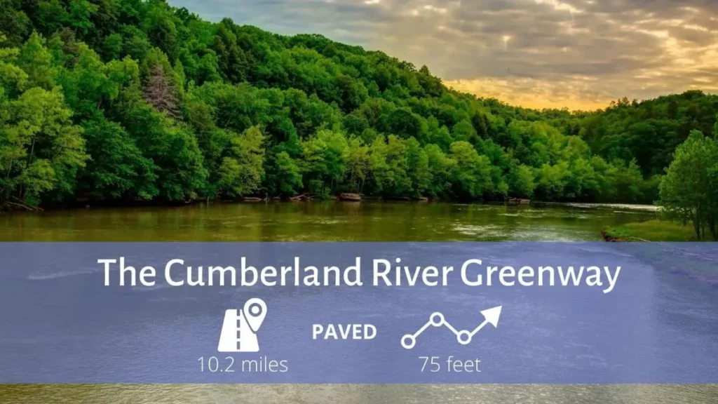
The Cumberland River Greenway follows a winding course along the Cumberland River through downtown Nashville. Most of the trail lies on the west/south bank of the river, running from Ted Rhodes Park to the Nissan Stadium, providing views of the river along the way.
Users can also access the trail at Morgan Park and Bicentennial Capitol Mall State Park. Despite the urban setting, the river's beauty is always with you, and the greenway passes historic sites and some fascinating installations of public art.
- Crooked Branch Park: 116 Ray Ave
- Riverfront Park: 170 1st Ave N
- Morgan Park: 411 Hume Street
- MetroCenter Levee: 102 Great Circle Rd
- Freeland Station: 766 Freeland Station Rd
- Ted Rhodes Park: 2015 Ed Temple Blvd
The Cumberland River Greenway is one of many systems of greenways throughout the city. Nashville's greenways link neighborhoods, schools, shopping areas, the downtown area, offices, recreation areas, open spaces, and other points of interest.
Shelby Bottoms
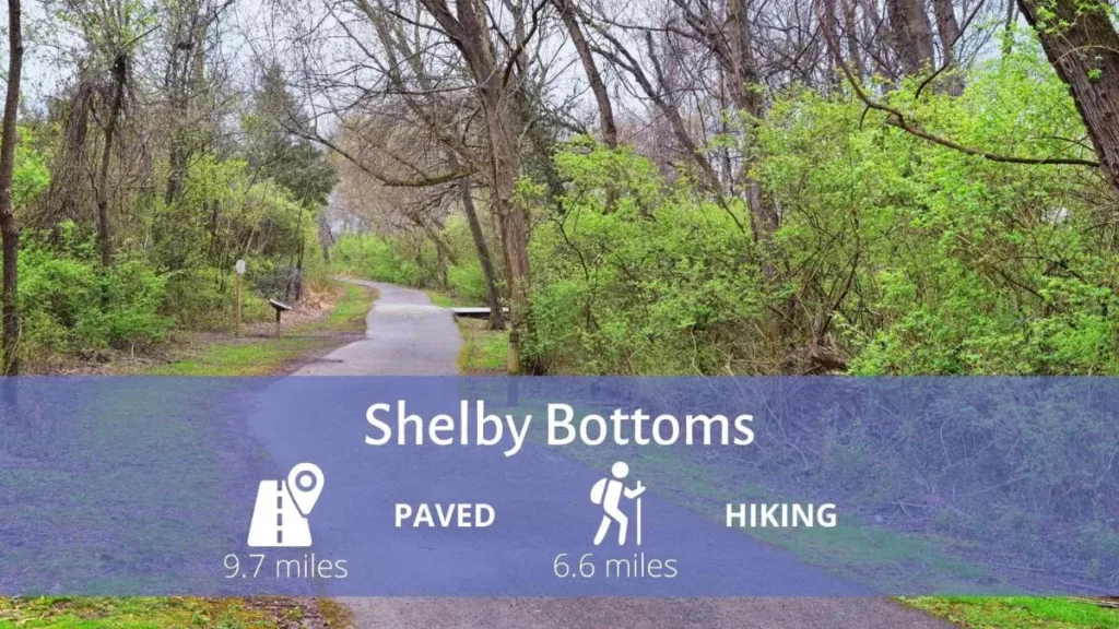
The Shelby Bottoms Nature Center marks the entrance to the Shelby Bottoms Greenway and Nature Park, a 950-acre floodplain preserve along the Cumberland River that features relatively flat, paved multi-use paths and unpaved trails, including overlooks and an observation platform for studying the local ecosystem.
The Cumberland River Pedestrian Bridge connects the Shelby Bottoms Greenway to the Stones River Greenway. The Nature Center is also a location for a Nature Play area and a Nashville B-Cycle bike share station.
Shelby Park is adjacent to Shelby Bottoms and is one of the earliest parks in the Metro Parks system. Shelby Park began in 1909 as a 151-acre purchase of land. Combined with Shelby Bottoms, the total amount of green space is over 1,200 acres.
Shelby Park includes baseball and softball facilities, a special events field, picnic areas, a dog park, Sevier Lake (which is a popular spot for fishing), a riverside boat ramp, a community center, and two public golf courses (the 18-hole Shelby Park Golf Course and the 9-hole Vinny Links).
- Shelby Park: 1900 Davidson St
- Forrest Green: 2031 Forrest Green Dr
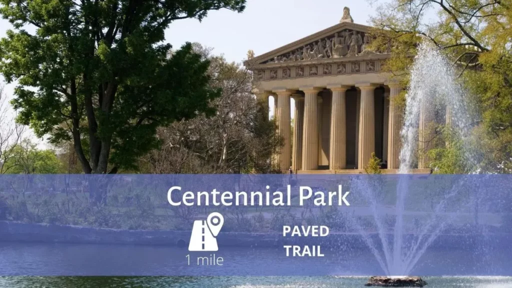
Centennial Park
Location: Downtown Nashville
Trail End Points: 2500 West End Avenue
Centennial Park is one of Nashville's premier parks. Located on West End and 25th Avenue North, the 132-acre features: the iconic Parthenon, a one-mile walking trail, Lake Watauga, the Centennial Art Center, historical monuments, an arts activity center, a beautiful sunken garden, a bandshell, an events shelter, sand volleyball courts, dog park, and an exercise trail.
Thousands of people visit the park each year to visit the museum, see exhibits, attend festivals, and just enjoy the beauty of the park.
Stones River Greenway
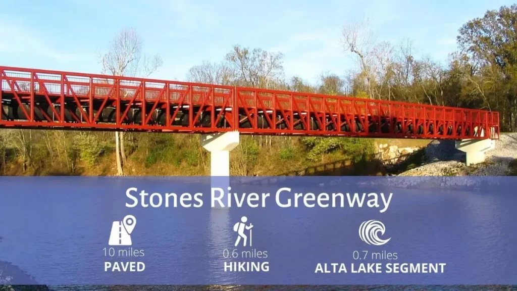
The Stones River Greenway consists of a paved trail system connecting Shelby Bottoms to Percy Priest Trailhead and dog park, as well as linking to the Lebanon Road YMCA, Heartland Park, Heartland River access, and the Cumberland River Pedestrian Bridge and Two Rivers Park along the way.
- J. Percy Priest Dam: 3778 Bell Rd
- Heartland Park: 3135 Heartland Dr
- Two Rivers Park: 3130 McGavock Pike
- Wave Country: 2320 Two Rivers Parkway
- Kohl’s: 2330 Jackson Downs Blvd
- Stone Hall: 1014 Stones River Rd
- Alta Lake: 3809 Dodson Chapel Rd
Richland Creek Greenway
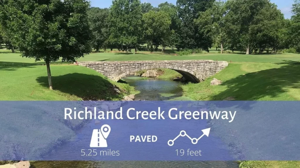
The Richland Creek Greenway is a multi-use trail that connects the neighborhoods of Sylvan Park and Cherokee Park with the shopping centers, entertainment areas, and schools along White Bridge Pike via three access points.
The greenway makes nearly a complete loop around McCabe Park, and a 1-mile portion of it follows the railroad tracks between White Bridge Pike and Cherokee Road.
Rail history buffs will want to stop at the White Bridge Road trailhead, where there is a historical marker for Dutchman’s Curve, the site of the Great Train Wreck of 1918, one of the worst rail accidents in the country's history.
Percy and Edwin Warner Parks
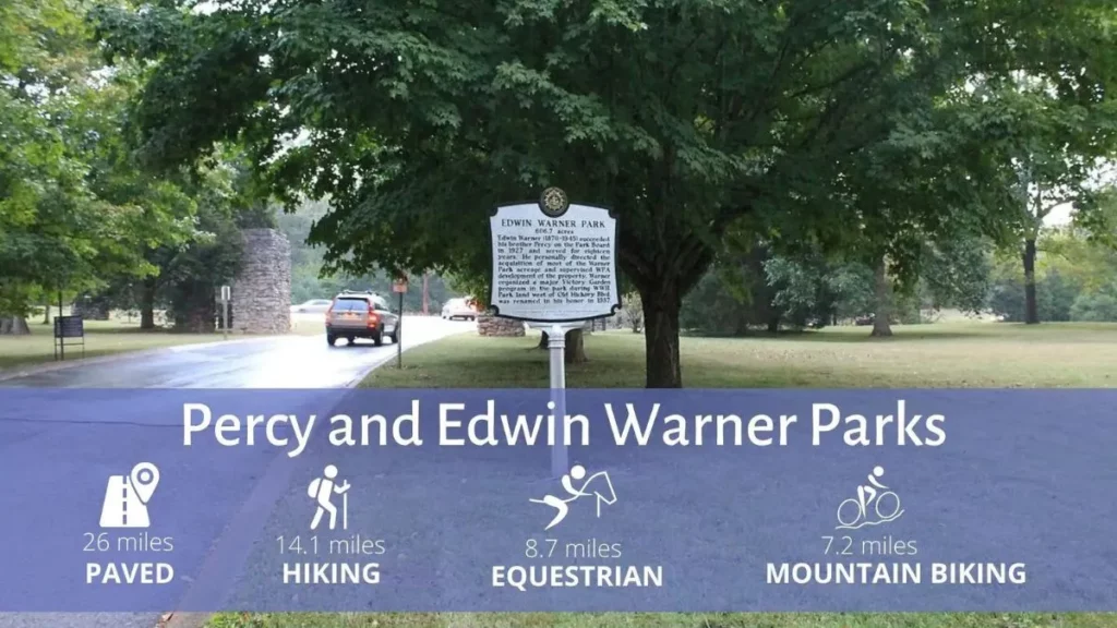
Percy and Edwin Warner Parks, at 3,100 acres, form one of the largest municipal parks in Tennessee and are listed on the National Register of Historic Places.
Percy Warner, the larger of the two parks, contains an extensive network of hiking trails as well as 8.7 miles of equestrian paths. Horse enthusiasts may also appreciate the unique Steeplechase racecourse, which hosts the annual Iroquois Steeplechase.
Picnic shelters scattered throughout the parks’ hills and hollows provide a rural and rustic setting for social events or family get-togethers. Two public golf courses (Percy Warner and Harpeth Hills) are within the park grounds.
26 miles of roads and multi-use trails run through the park, with a 5-mile loop dedicated to bikes and pedestrians only. The historic entrance at the end of Belle Meade Blvd leads straight to a set of impressive stone steps known as “The Allee” and serves as a nice jumping-off point for exploring the park’s rugged topography.
Edwin Warner Park, separated from Percy Warner by Old Hickory Blvd, has its own set of hiking trails, as well as Metro Park’s flagship Warner Parks Nature Center.
Edwin Warner is home to 9 reservable picnic areas, a dog park, and the Old Roadway, a multipurpose trail that is closed to motor vehicles. The park hosts two trailheads that are the starting points of the Harpeth River Greenway system. The two parks are connected by a trail that crosses Old Hickory Blvd.
Percy Warner Park: 7311 Hwy 100
Edwin Warner Park: 50 Vaughn Rd
Harpeth River Greenway
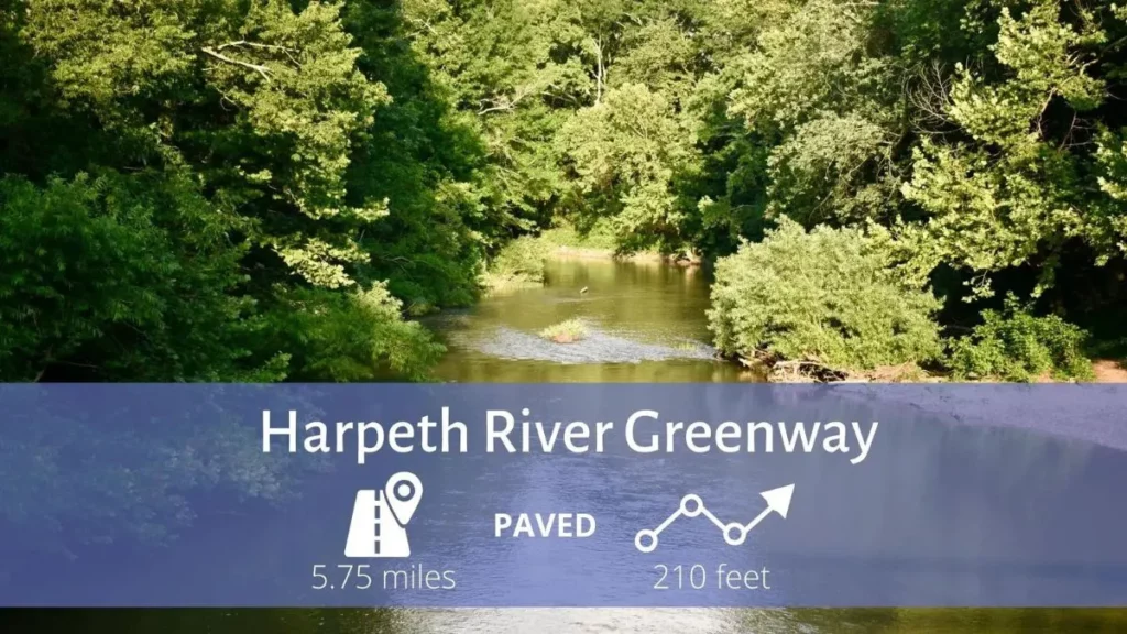
The Harpeth River Greenway is a series of four disconnected, multi-use trails that run along the Harpeth River in suburban Nashville. The various segments serve a variety of communities and parks throughout the city.
The segments are known locally as:
Harpeth Youth Soccer Association, from Harpeth River Park, across the river to a loop in Bellevue Park, and returns. There are plans to build a connector trail from the shopping center off US 70S/SR 1/Memphis-Bristol Hwy.
Morton Mill, follows Morton Mill Road from Old Harding Pike north. Future plans will connect this segment with the Harpeth Youth Soccer Association segment.
Warner Park to Bellevue Exchange Club, from near the end of McPherson Drive along the river to Edwin Warner Park. There are two spurs at the park: one short section follows the river (875 feet) and the other heads north away from the river toward SR 100.
Riverwalk, from the end of Wood Stream Drive along the river north then west to near the end of Westvale Drive in the same subdivision. There are access points from the subdivision at Watervale, Rivervalley, Bridgeport, and Westvale drives.
See other details or routes here: https://greenwaysfornashville.org/individual-maps/
Beaman Park
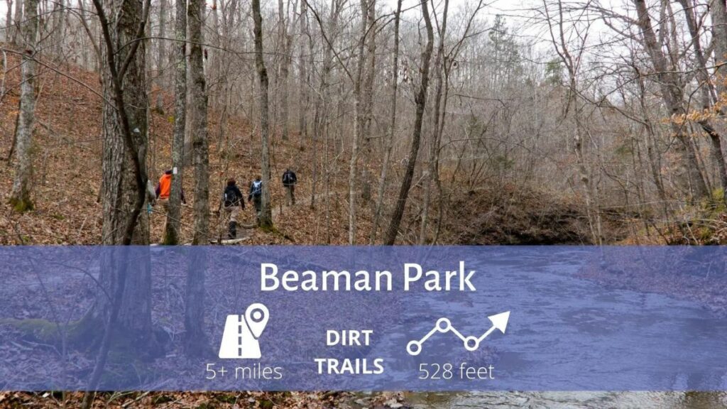
Location: Whites Creek
Trail End Points: 4111 Little Marrowbone Rd./5911 Old Hickory Blvd
One of the most botanically diverse places in Tennessee, this 1693 acre park in northwestern Davidson County consists of 5 miles of primitive hiking trails and boardwalks in a natural Highland Rim forest. The Beaman Park Nature Center provides a hub from which to explore a hilly landscape with narrow hollows, pristine streams, and cascading waterfalls as well as two easy quarter-mile trails (one at the Little Marrowbone Rd entrance and the other, encircling the nature center).
Long Hunter State Park
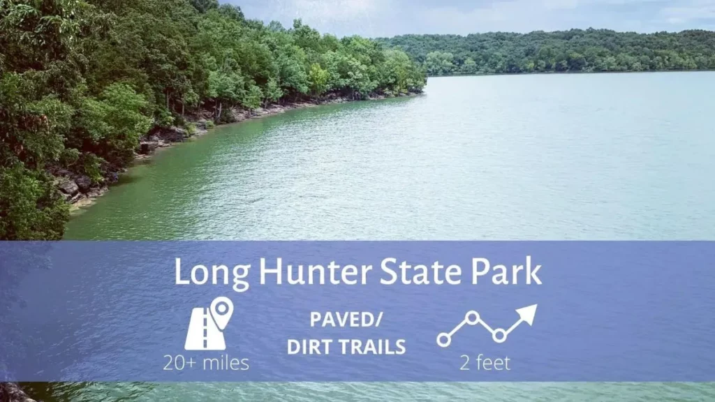
Location: Hermitage
Trail End Points: 2910 Hobson Pike
Long Hunter State Park sits on 2600 acres and includes four sections: Couchville, Baker’s Grove, Bryant Grove, and Sellars Farm. This is a park for the entire family – visitors may enjoy fishing, hiking, camping, a backcountry campsite, and an archaeological area at Sellar’s Farm.
With more than 20 miles of hiking trails, the variety of terrain and habitats is sure to please hikers of all levels from strollers to adventurers. The Sellar’s Farm State Archaeological Area is a Native American site with artifacts ranging from 900 AD to 1500 AD.
Music Row
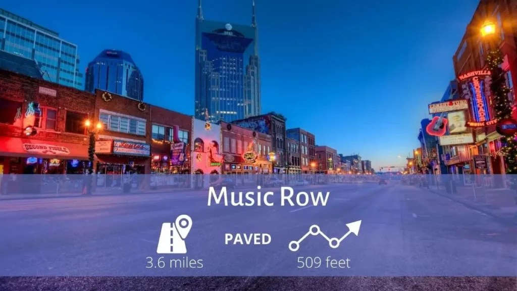
Start: Owen Bradley Park
The sidewalk-lined streets on Music Row are surrounded by record labels, publishing houses, recording studios, and more. Runners who enjoy a cityscape can run along 3 or 4 miles with moderate elevation changes.
Begin at Owen Bradley Park and run down Music Square East for one block before turning onto Roy Acuff Place. Take Roy Acuff two blocks to 18th Avenue South and pass Historic RCA Studio B. Circle back to Music Square East and continue on until the street becomes 16th Avenue South. After another half mile or so you’ll run into Edgehill Village, where you’ll pass boutiques, restaurants, and specialty shops.
If you want to explore, circle around a few blocks before heading west on Edgehill Avenue to 21st Avenue. Then turn right and run alongside 21st until you reach Grand Avenue. Then turn right again and make a quick left back on Music Square East to return to your starting point.